South Yorkshire public transport maps
We produce a range of route and network maps for bus, tram and train services in South Yorkshire, plus maps of city centre and town centre bus stop locations.
.png)
Bus route and network maps
Route maps for bus services in South Yorkshire can be viewed and downloaded in our PDF timetable leaflets. These maps show the routes and stopping points for the service, and are also labelled with timing points, interchanges and key points of interest. Use our timetable finder to search for your service:
You can also use the Travel South Yorkshire journey planner to view the route of your journey and services. Once you have input your journey details you'll be able to see each stage of your journey on an interactive map.
Our network maps display all frequent bus routes within each district on a single map. These maps can be helpful to see all the different bus service options for an area.
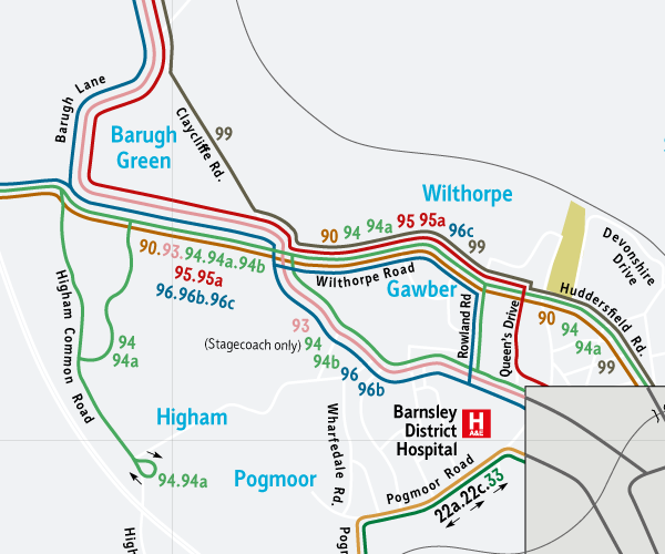
Barnsley Network Map
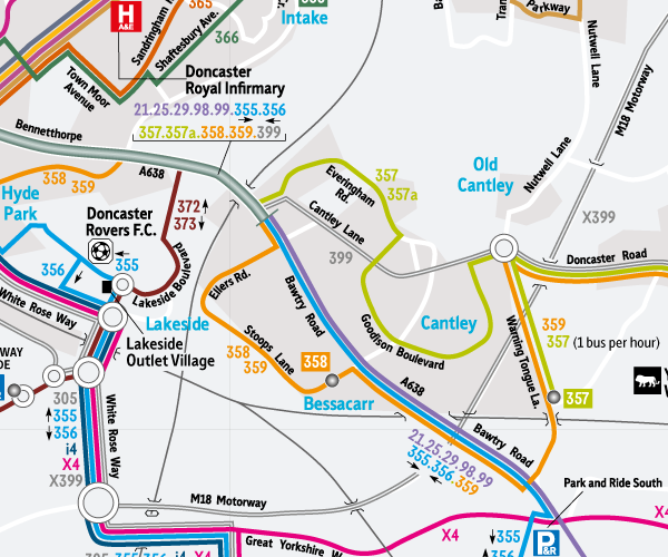
Doncaster Network Map
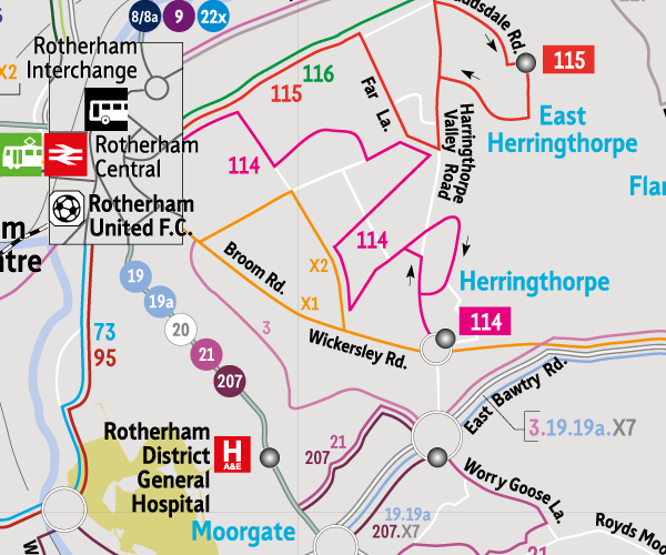
Rotherham Network Map
Download Rotherham Network Map
This map is also displayed at:
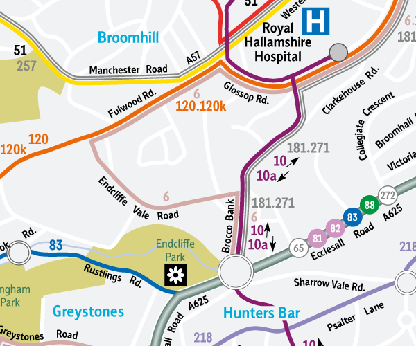
Sheffield Network Map
Tram route and network maps
Find out more information about the Supertram network, including facilities at tram stops such as cycle parking and nearby destinations including stadiums and parks, by using our route and network maps:

Barnsley Town Centre
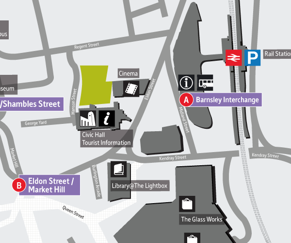
Download Barnsley Town Centre Bus Stop Map (PDF 273kb)
This map is also displayed at:
- Barnsley Interchange
- At certain bus stops in Barnsley town centre
Doncaster City Centre
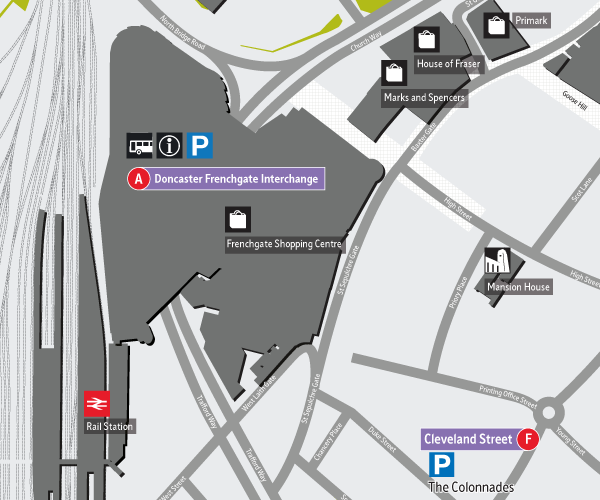
Download Doncaster City Centre Bus Stop Map (PDF 454kb)
This map is also displayed at:
- Doncaster Interchange
- At certain bus stops in Doncaster city centre
Rotherham Town centre
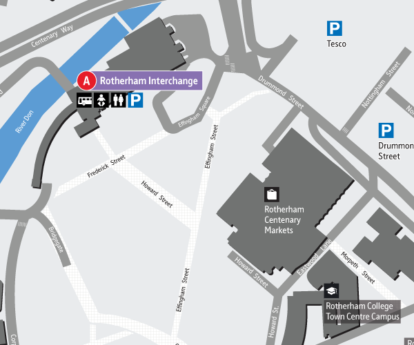
Download Rotherham Town Centre Bus Stop Map (PDF 653kb)
This map is also displayed at:
- Rotherham Interchange
- At certain bus stops in Rotherham town centre
Sheffield City centre
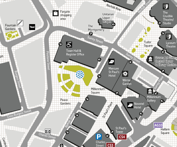
Download Sheffield City Centre Bus Stop Map
This map is also displayed at:
- Sheffield Interchange
- At bus stops throughout Sheffield city centre
.png)
Cycle route maps
There are a variety of sources of information for cycle routes throughout South Yorkshire. View more information on our cycle route planning page, or take a look at the new South Yorkshire By Bike route, a new 250km route which visits every corner of South Yorkshire.